I love it when more than one of my hobbies come together in a small, contained project. This time it was biking, photography, urban exploration, and programming. I am not extremely good or talented at any of them, but doing and enjoying lots of different things and being okay at them is a good way to roll. You never know when things will intersect in interesting ways!
I like to get out on my bike or on foot and just explore the city. You see so much more using slow modes of transport than you do driving around. I am particularly interested in observing and documenting how places are changing. Over the years I have developed a bit of a sixth sense for places that will look very different a few years from now. Sometimes, imminent change is obvious:
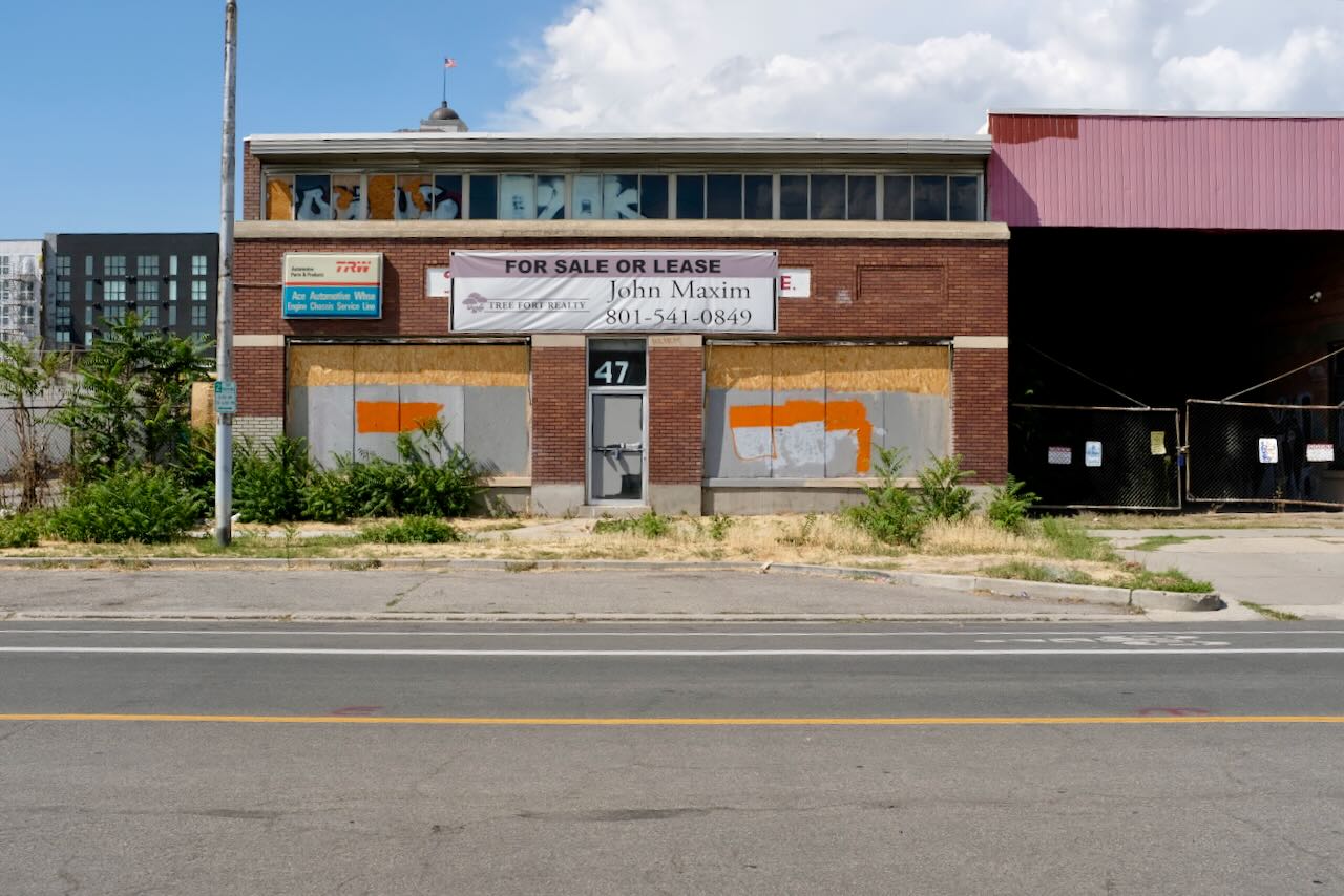
But often, not so much:

Anyway, I like exploring and documenting the not-so-remarkable places in my city. I created an instagram account to post some of my photos, but I am not on instagram often, and I wanted a way to share photos in a way that I can better control. I wanted a page that has a map showing the locations of the photos I took on during bike ride, that let you click the photo locations to show the photo and perhaps some information about them.
Curiously enough, I did not find a great way to make a page like that. So I took it as an opportunity to hack something together. And a day later, I have something I am happy with! It's called geotagged-photos-to-webpage. Naming things is not one of my hobbies. It is cobbled together using technologies I know just enough about: Python, HTML, a bit of Javascript, and Leaflet (a Javascript mapping library).
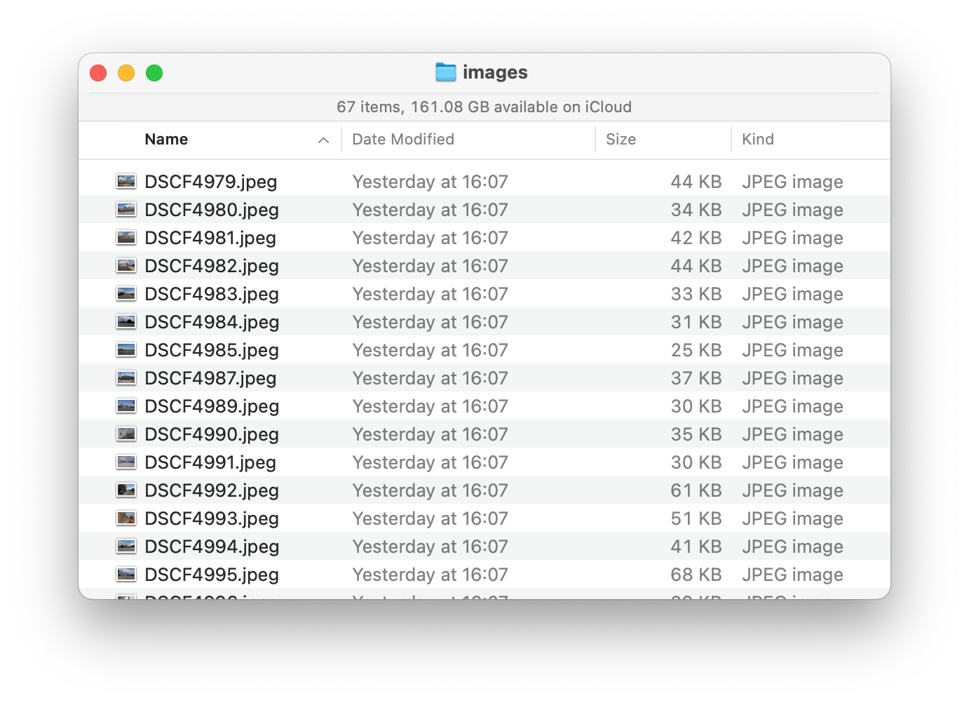
geotagged-photos-to-webpage takes a directory of photos in jpg format as input:
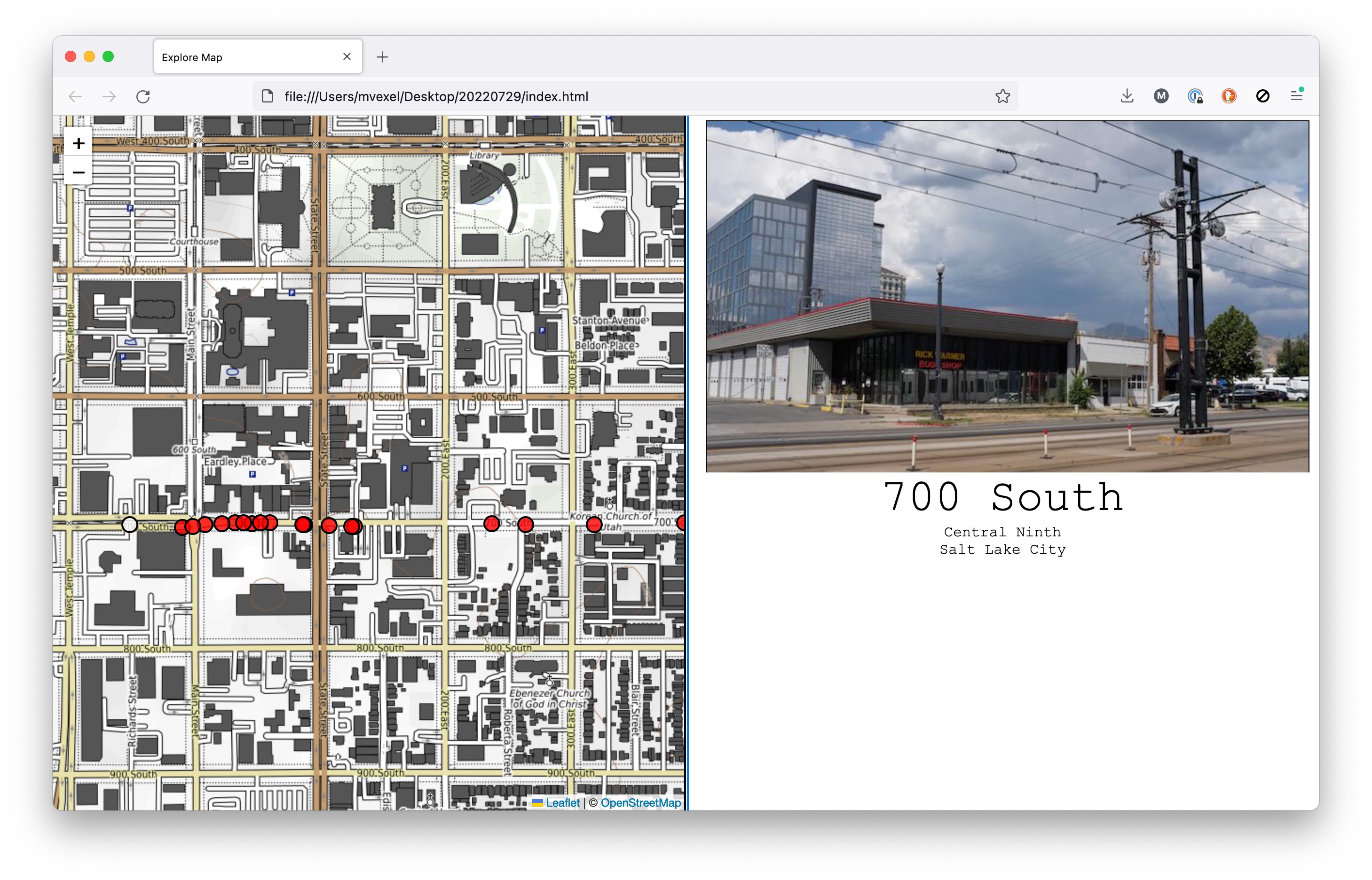
...and outputs an HTML page with a nice interactive map!
This is one of the hackier things I put together in recent times. The script basically works like this:
- Iterate over a directory of jpg files
- For each file, read EXIF location tags
- Generate a GeoJSON string from all photo locations
- Inject this GeoJSON into a HTML template file
- Save HTML and move images into place
The HTML template itself is just some plain old handwritten HTML and Javascript. I started with a basic Leaflet template, added some basic CSS, and some custom JS to connect map interactions with the rest of the page, and do some reverse geocoding. Good enough for me!
Here's an example map page. Happy with it!